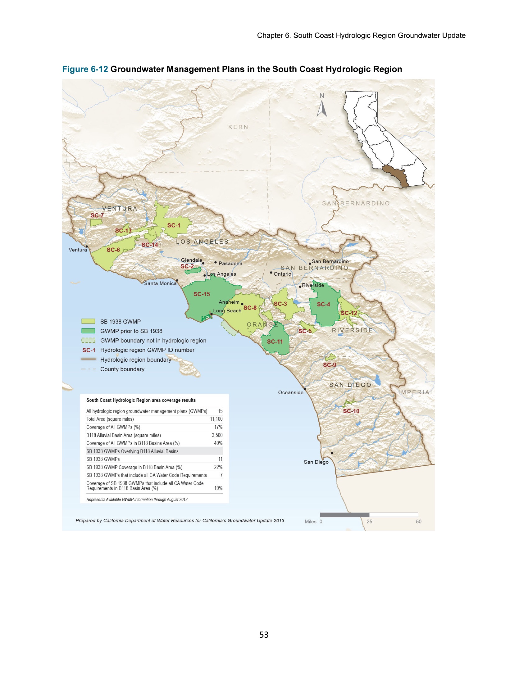
The image shows a poster with a map of the South Coast Hydrologic Region and text detailing groundwater management plans.
Read full description
The image shows a poster with a map of the South Coast Hydrologic Region and text detailing groundwater management plans. The map is detailed and shows the various areas of the region, including rivers, lakes, and other geographical features. The text provides additional information about the plans, such as the type of water used, the amount of water available, and the estimated time it will take to complete them.