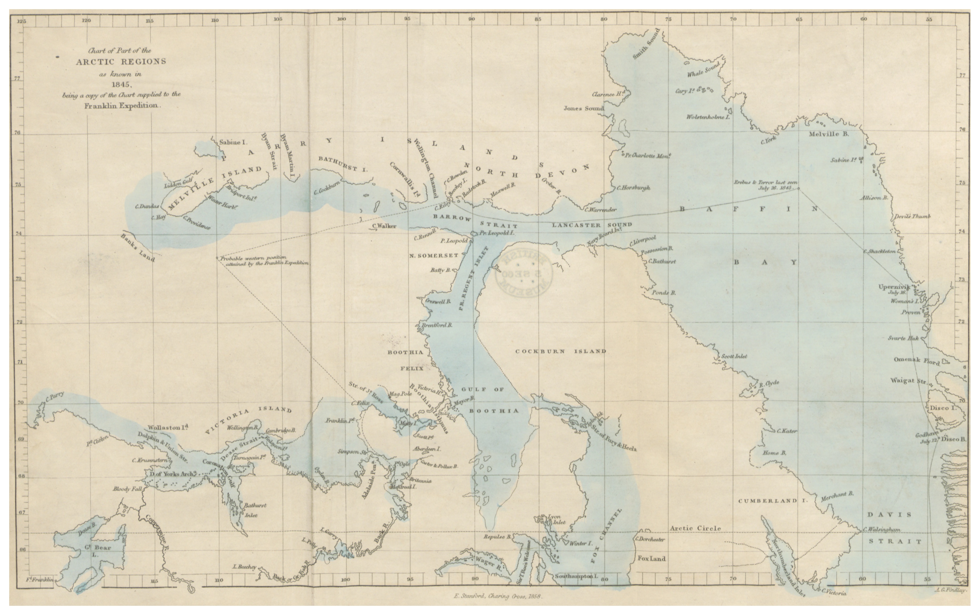
The image shows an old map of the British Isles, depicting the extent of the Arctic region.
Read full description
The image shows an old map of the British Isles, depicting the extent of the Arctic region. It is a detailed map, showing the various geographical features of the region, such as rivers, mountains, and cities, as well as the various bodies of water that make up the region. The map also includes labels for cities, towns, and other geographical features.