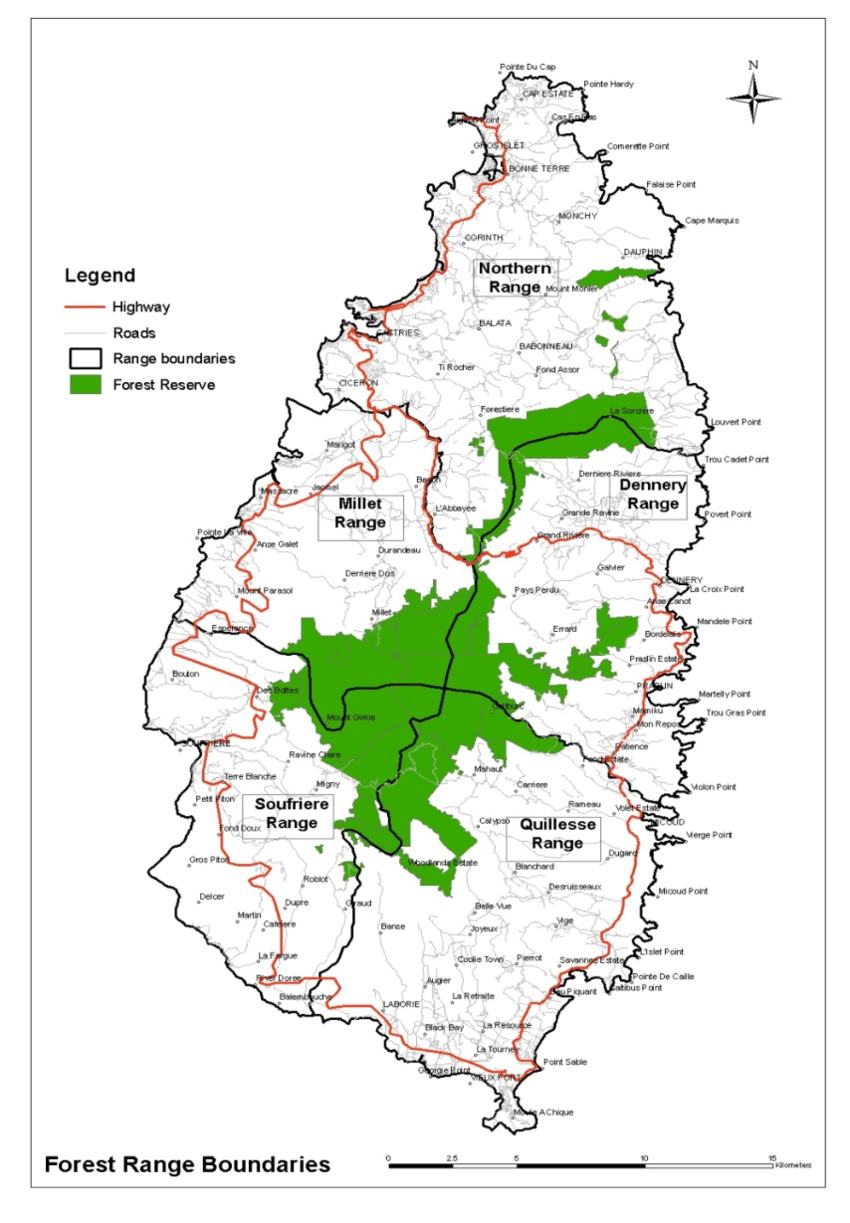
The image shows a poster with a map of a forest range boundary, with text and a navigation symbol.
Read full description
The image shows a poster with a map of a forest range boundary, with text and a navigation symbol. The map is filled with various shades of green, indicating the different levels of vegetation in the forest. The text on the poster provides additional information about the boundaries of the forest, such as the type of vegetation, the number of trees and shrubs, and the location of the boundaries. The navigation symbol is located at the top right corner of the poster.