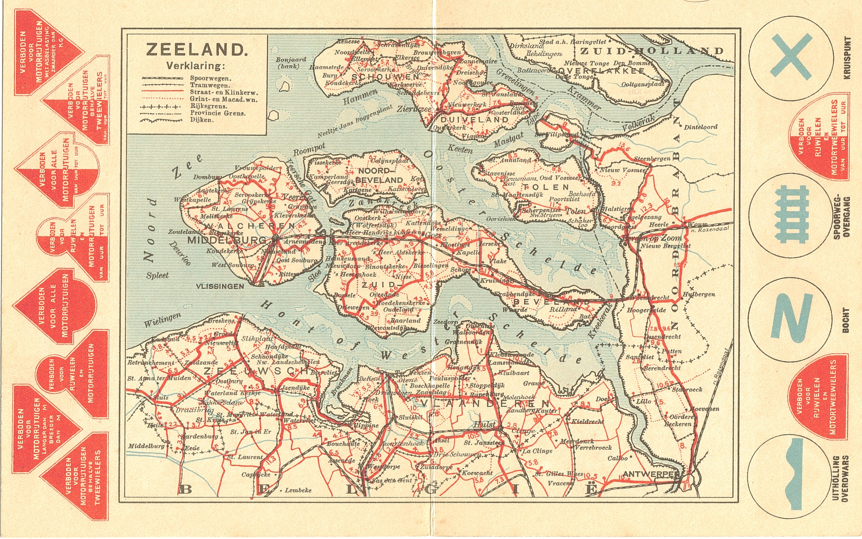
The image shows a poster of a map of the Netherlands with red and blue lines indicating the route of a train.
Read full description
The image shows a poster of a map of the Netherlands with red and blue lines indicating the route of a train. The map is detailed and shows the various cities and towns along the route, as well as the various bodies of water and other geographical features. The red lines indicate the various stops along the way, while the blue lines represent the roads and highways that make up the route.