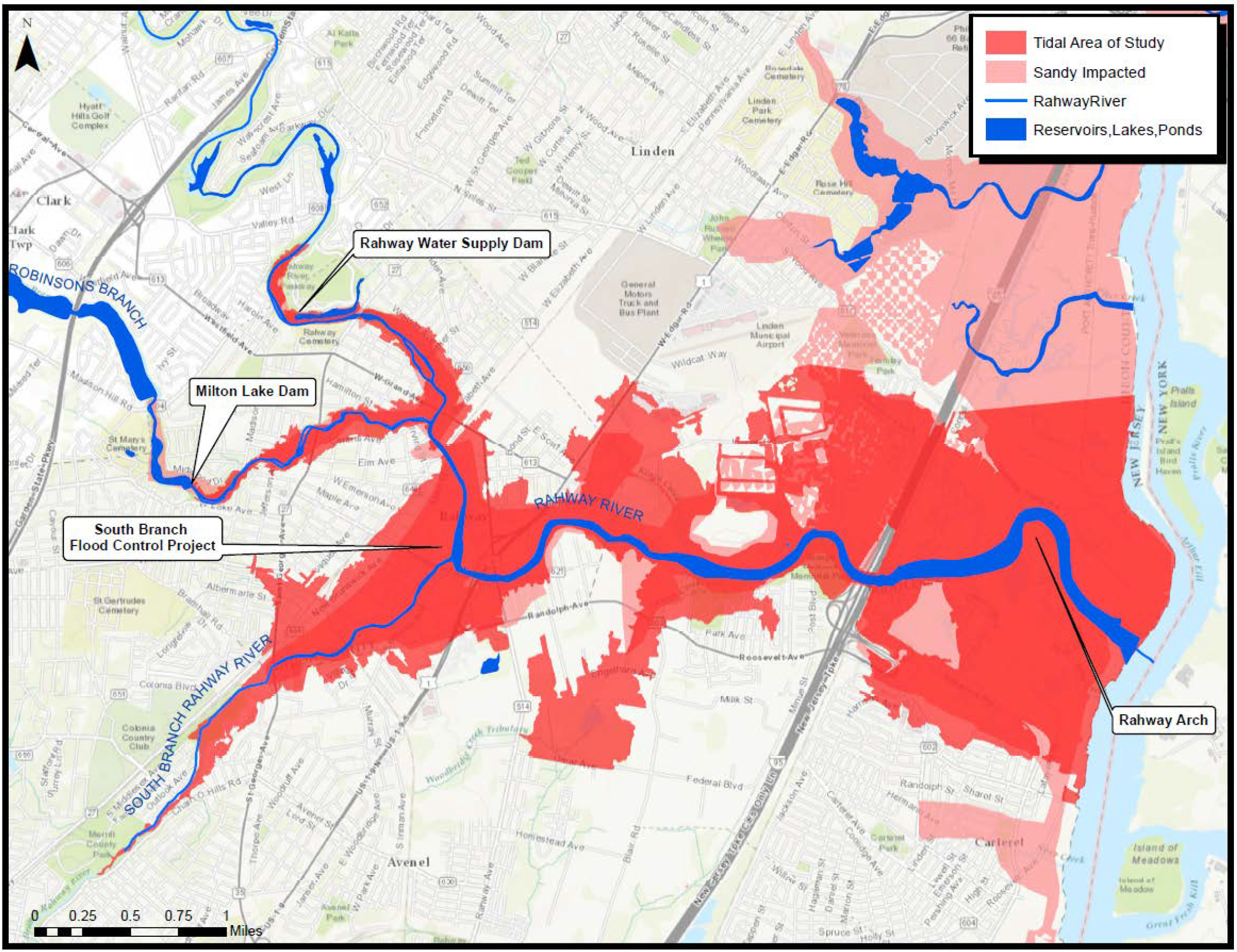
The image shows a map of the city of New York City with a red and blue color scheme, indicating the extent of the proposed flood risk.
Read full description
The image shows a map of the city of New York City with a red and blue color scheme, indicating the extent of the proposed flood risk. The text on the map provides further details about the flood risk, such as the type of water that is affected by the flood, the number of people affected, and the estimated time it will take to complete the project.