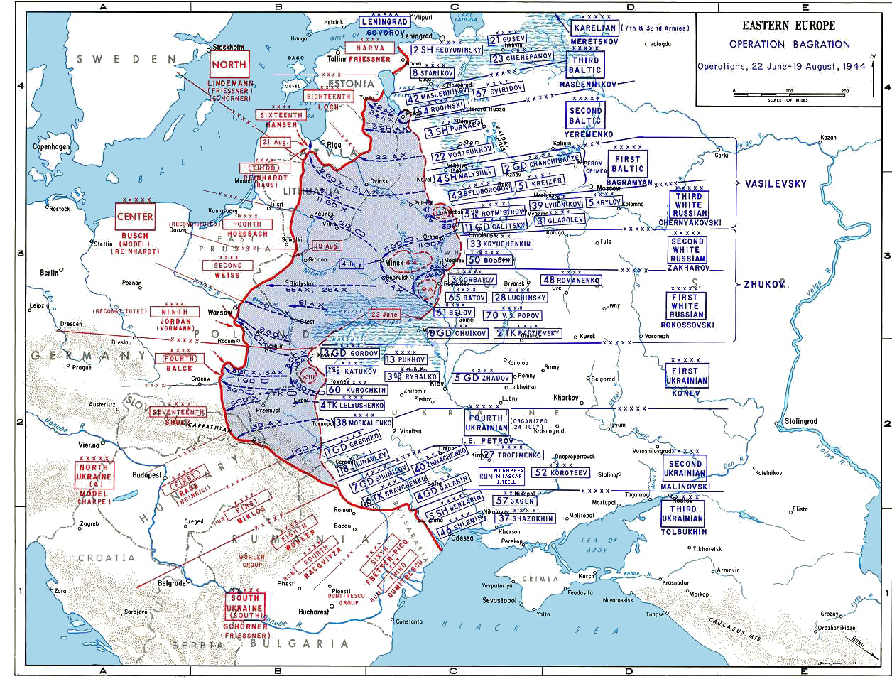
The image shows a poster with a map of the Eastern Europe during World War II, with text and numbers indicating the extent of the British Empire.
Read full description
The image shows a poster with a map of the Eastern Europe during World War II, with text and numbers indicating the extent of the British Empire. The map is detailed, showing the various countries and their borders, as well as the major cities and towns within the region. The text on the poster provides additional information about the war, such as the names of the countries involved and the dates of the battle.