Public domain photos
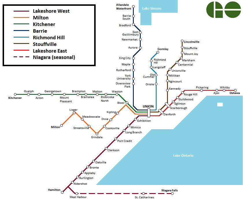
The image shows a map of the Niagara Falls Metro System, with a logo in the top right corner. The map is detailed, showing the various stops and lines of the metro system, as well as the surrounding area.
 Open in library
Public domain photos
Open in library