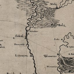
The image shows an old map of the British Empire in the 19th century, depicting the battle of Sokal.
Read full description
The image shows an old map of the British Empire in the 19th century, depicting the battle of Sokal. It is a detailed map, showing the various cities, towns, and other geographical features of the area. The map is filled with intricate details, such as rivers, mountains, and cities, as well as labels for each city and town. The colors used in the map are mostly shades of blue, green, and yellow, giving it a vintage feel.