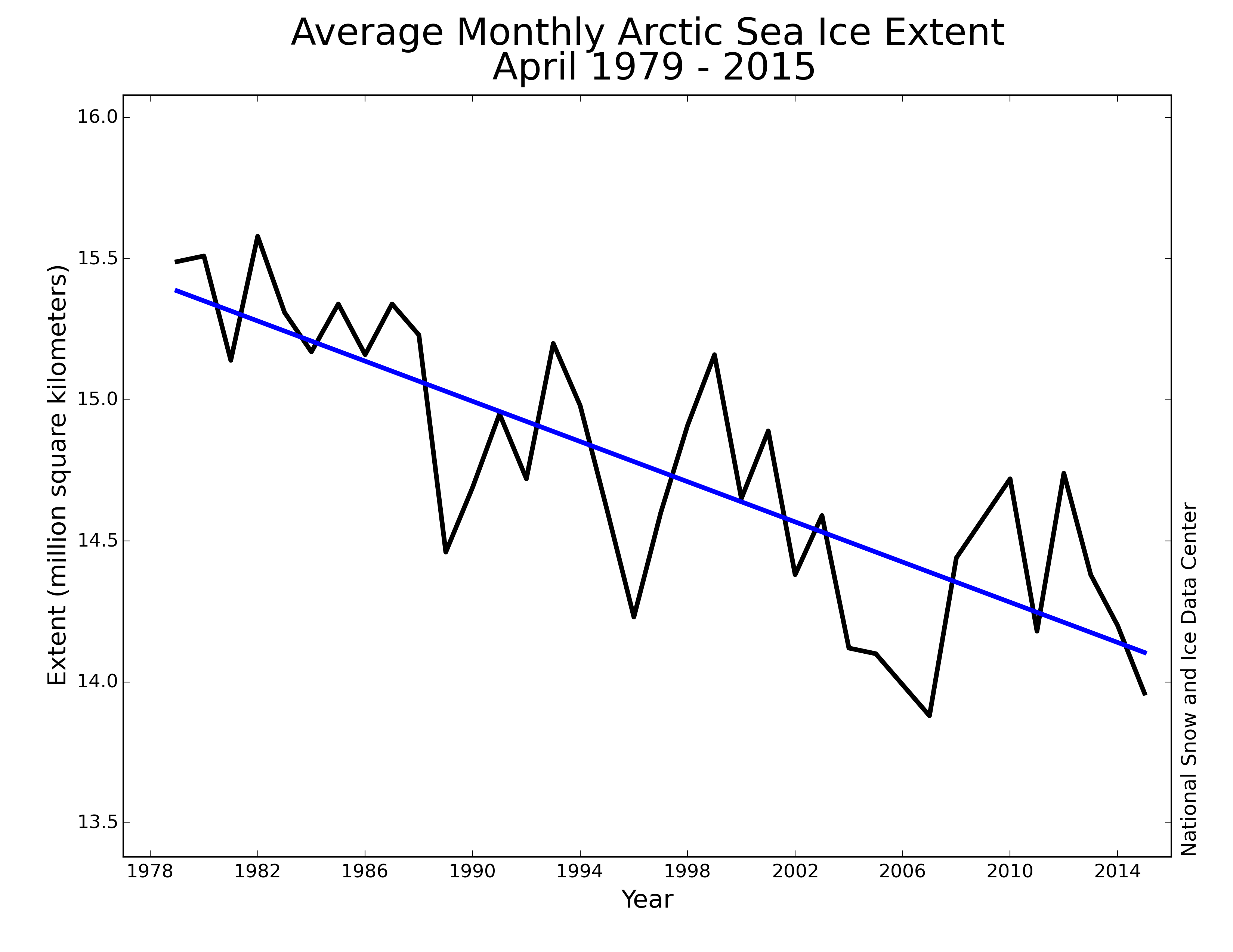
The image shows a graph of the average monthly arctic sea ice extent from April 1979 to 2015.
Read full description
The image shows a graph of the average monthly arctic sea ice extent from April 1979 to 2015. The graph is composed of a series of points connected by a line, with the x-axis representing the months of the year and the y-axis indicating the extent of the ice. The points on the graph indicate the amount of ice in each month, ranging from low to high.