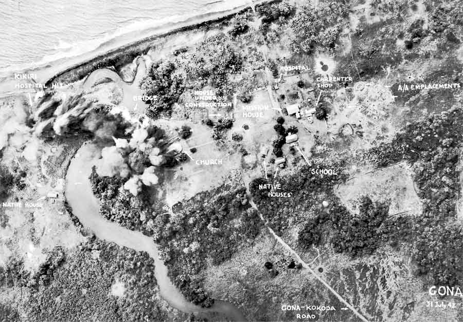
The image shows an aerial view of a small town on the beach, with trees, houses, and water visible.
Read full description
The image shows an aerial view of a small town on the beach, with trees, houses, and water visible. It is a black and white image, and it is believed to be the site of the Gona-Kokoda Road bombing, as indicated by the text at the bottom of the image.