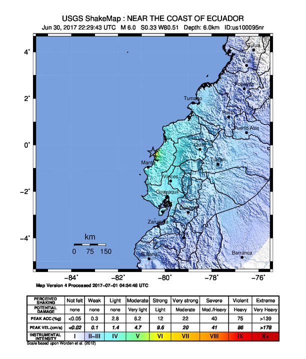
The image shows a map of Ecuador with text and numbers indicating the location of the USGS Shakemap near the coast.
Read full description
The image shows a map of Ecuador with text and numbers indicating the location of the USGS Shakemap near the coast. The map is filled with various shades of blue, indicating the varying levels of seismic activity in the region. The text on the map provides additional information about the earthquake, such as its magnitude, location, and intensity.