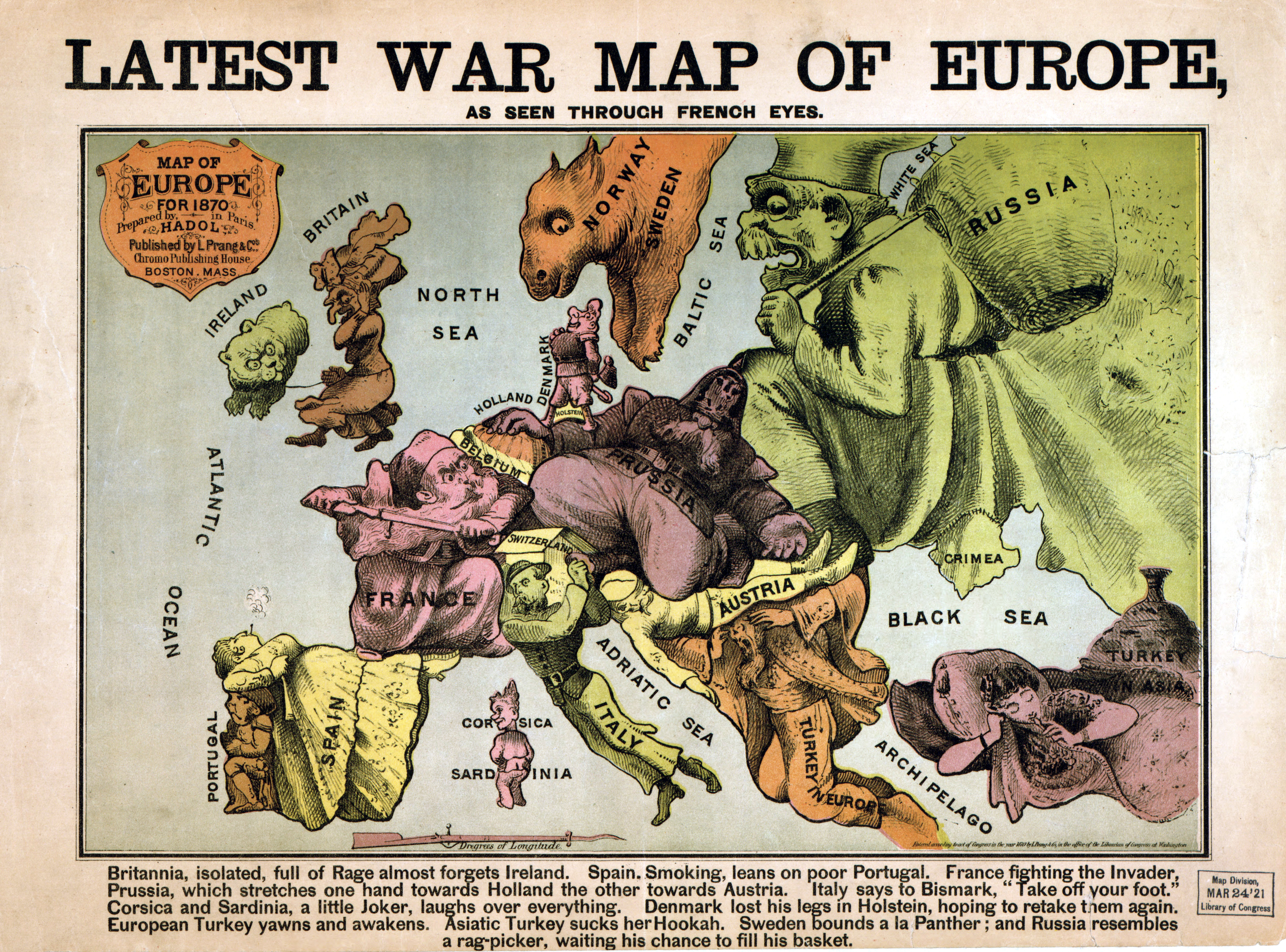
The image shows a poster with a map of Europe in the center, surrounded by cartoon images and text.
Read full description
The image shows a poster with a map of Europe in the center, surrounded by cartoon images and text. The map is detailed and shows the various countries and regions of Europe during the war. The cartoon images depict various characters and symbols, such as mountains, rivers, and cities, as well as other geographical features. The text on the poster reads "Latest War Map of Europe".