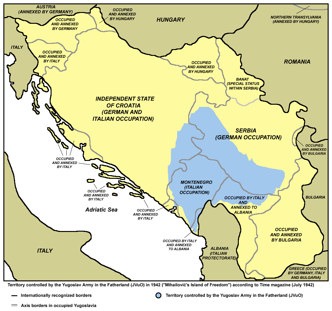
The image shows a poster with a map of Croatia and Serbia, with text indicating the extent of the conflict between the two countries.
Read full description
The image shows a poster with a map of Croatia and Serbia, with text indicating the extent of the conflict between the two countries. The map is divided into two sections, with Croatia on the left and Serbia on the right. The text on the poster provides further details about the conflict, such as the names of the countries involved and the countries that were involved.