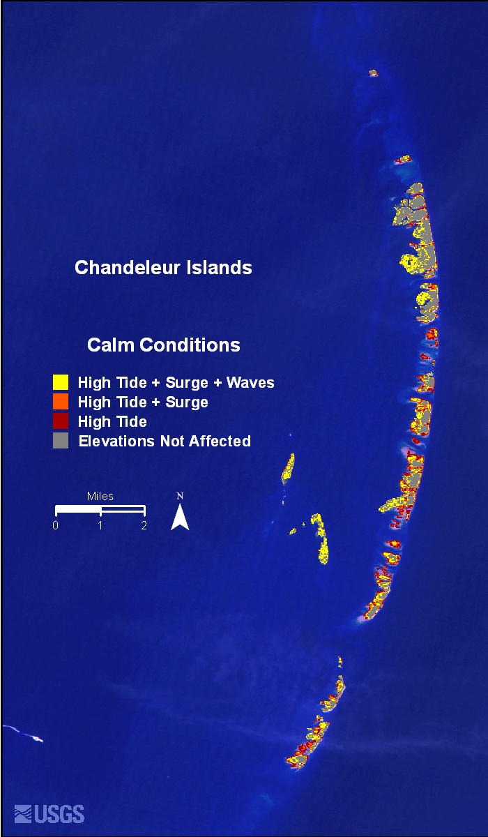
The image shows a satellite view of Chandeleur Islands in the Indian Ocean, with text and navigation symbols visible.
Read full description
The image shows a satellite view of Chandeleur Islands in the Indian Ocean, with text and navigation symbols visible. The map is filled with various shades of blue, green, and yellow, indicating the various islands and bodies of water that make up the island. The text on the screen provides additional information about the islands, such as their size, location, and other features.