A network of roads and scattered buildings defines this area.
Read full description
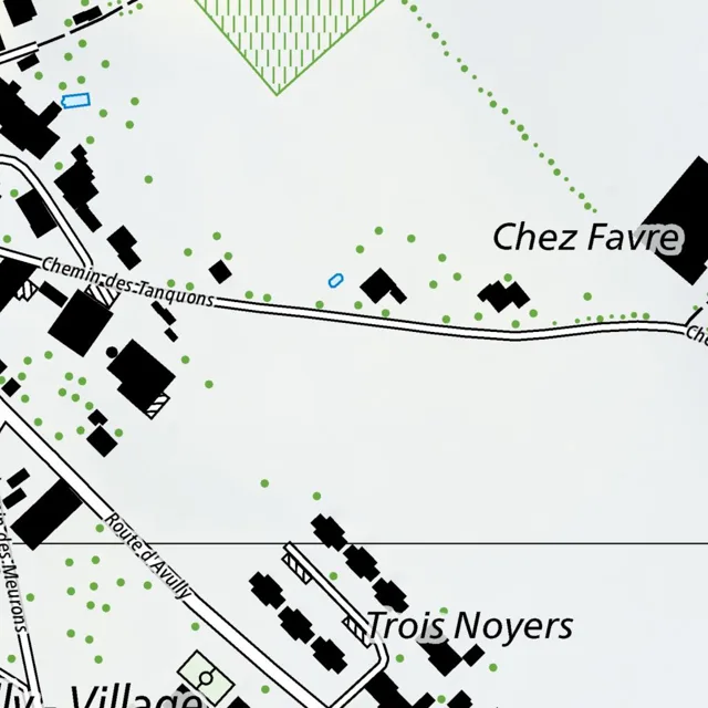
A network of roads and scattered buildings defines this area. In the upper left, a cluster of black rectangular buildings is arranged along a road that curves from the top edge downward. A blue outline of a small structure sits just east of this cluster. Further south, the road continues as Chemin des Tanquons, running horizontally across the center of the map. Along this road, several black buildings are spaced apart, with one larger complex on the left and several smaller ones to the right. To the east of Chemin des Tanquons, the text "Chez Favre" is positioned above a group of three black buildings.
In the lower portion of the map, Route d'Avully runs diagonally from the center-left toward the bottom right. This road intersects with another path coming from the left, labeled "les Meurons." Along Route d'Avully, a series of black rectangular structures are aligned linearly, leading toward the text "Trois Noyers." Below this, another road curves toward the bottom left, passing by the text "Village."
Green dots are scattered throughout the landscape, with a higher concentration in the upper left and lower left areas. In the top center, a triangular area is filled with green vertical stripes. A dotted green line curves from the top center toward the right edge of the map. Small blue outlines of structures are sparsely placed, one in the upper left and another near the center.