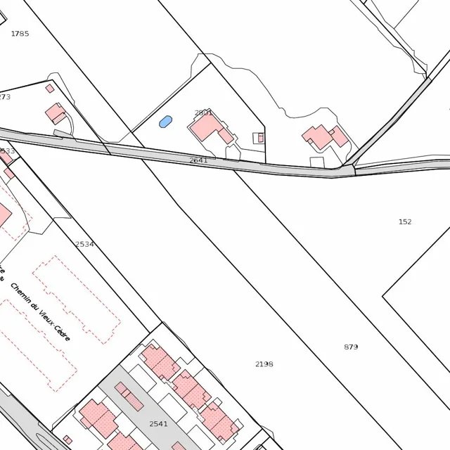
A network of black boundary lines divides the landscape into irregularly shaped parcels of land.
Read full description
A network of black boundary lines divides the landscape into irregularly shaped parcels of land. A primary road runs horizontally across the center, curving slightly as it moves from west to east, with the number 2641 printed along its path. To the north of this road, several small, light-pink rectangular structures are clustered, including one labeled 2801 and another nearby with a small blue oval shape adjacent to it. These structures are enclosed within their own smaller boundary lines. Further north, a larger, open parcel is marked with the number 1785.
South of the main road, the land is divided by long, diagonal boundary lines sloping from the northwest to the southeast. A large open area is marked with the number 152 on the right and 879 toward the bottom center. To the west, a dashed red line outlines a rectangular area, and a label reads "Chemin du Vieux-Cèdre" along a path that runs diagonally. In the bottom left and center, a denser cluster of light-pink rectangular buildings is arranged in a row, with the number 2541 placed among them. These buildings are connected by a gray-shaded area that suggests a paved surface or driveway. A smaller road or path curves from the bottom left corner toward the center, intersecting with the boundary lines of the residential cluster. Other parcel numbers, such as 2534 and 2198, are scattered across the open white spaces between the boundaries.