A network of black boundary lines divides the landscape into irregular polygons of varying sizes and shapes.
Read full description
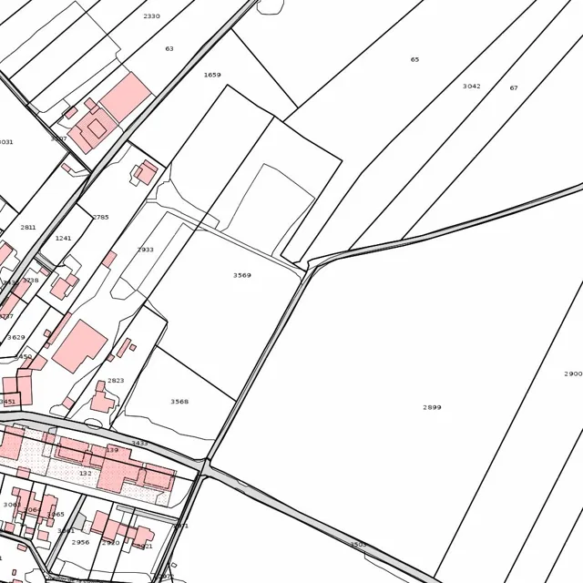
A network of black boundary lines divides the landscape into irregular polygons of varying sizes and shapes. In the upper right and central right areas, large, elongated parcels dominate, including plot 65, plot 3042, plot 67, and the expansive plot 2899. These large areas are separated by long, straight diagonal lines that run from the upper left toward the lower right.
In the upper left and central left sections, the land is divided into much smaller, more complex plots. Several of these smaller areas are highlighted in light pink, indicating built-up structures or specific land uses. These pink shapes are clustered primarily along a road or path that winds from the top left toward the center. Plot 2330 is located at the very top, with plot 63 and plot 1659 situated just below it. Further down and to the left, a cluster of pink buildings surrounds plot 2811 and plot 1241.
A prominent road or boundary line cuts diagonally across the lower half of the image, separating plot 3568 and plot 3569 from the large plot 2899 to the east. To the left of this diagonal line, there is a dense concentration of small, pink-shaded rectangular plots, including those labeled 132 and 139. These are interspersed with smaller white parcels such as 2823 and 3437. In the bottom left corner, further small plots are identified by numbers such as 3003, 2956, and 2920, with additional pink structures clustered tightly together.
The overall layout shows a transition from a densely developed area with many small, interconnected plots and buildings on the left to a more open landscape with large, expansive fields on the right. The boundary lines create a web of intersections, with some roads running parallel to the diagonal axis and others cutting across it perpendicularly.