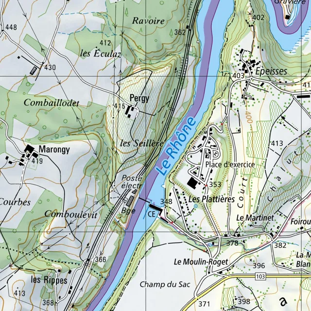
The Rhône river flows from the north towards the south, curving slightly to the west.
Read full description
The Rhône river flows from the north towards the south, curving slightly to the west. Its banks are lined with steep, shaded terrain, particularly on the west side where the land rises sharply. Along the western bank, a railway line runs parallel to the river, cutting through the landscape from north to south.
On the west side of the river, the terrain is characterized by rolling hills and scattered settlements. In the north, the area of Ravoire is marked by elevation 362, with the hamlet of les Éculaz situated nearby at elevation 412. Further south and west, the settlement of Combaillodet sits in a valley, while Marongy is located further west at elevation 419. Between Marongy and the river lies the area of Comboulevit. The settlement of Pergy is positioned on a slope overlooking the river, with les Seillère located just south of it. Near the river's edge, the Poste électr. and the area of Boé are situated, with elevation 348 marked near the water. Further south, the area of les Rippes is noted, with elevations 366 and 368.
On the east side of the river, the settlement of Epeisses is located in the north at elevation 403. South of Epeisses, the landscape opens into a flatter area featuring a Place d'exercice and the settlement of Les Plattières at elevation 353. To the east of Les Plattières, the land rises toward the area of Le Martinet, with elevation 413 and 382 nearby. The area of Foirou is located further east. To the south, the terrain descends toward Le Moulin-Roget at elevation 378 and Champ du Sac, with elevations 396, 398, and 371. A road, marked 103, runs east-west across the southern portion of the map.
Roads connect the various settlements on both sides of the river. On the west, roads link Ravoire, les Éculaz, Pergy, and Marongy. On the east, roads connect Epeisses, Les Plattières, and Le Moulin-Roget. The railway line on the west side serves as a major north-south artery, passing through the steep terrain and near the river's edge.